Indian Remote Sensing Satellite
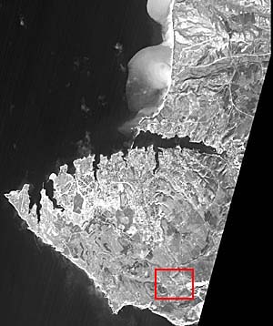
 This IRS panchromatic satellite image was acquired in October 1997. Because of its high spatial resolution (5m) it has been designated as the base image to which all the other data are registered. Although the spatial resolution of the Corona data is slightly higher (as high as 2.5m), less information can be reconstructed about the Corona missions. The zoom view of the area highlighted in red above indicates the excavated archaeological site, known as Bezymyannaya, and surrounding areas. The site is visible in the zoom views below.
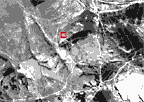 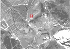
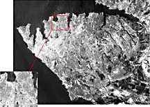
The image on the right is a close-up view of the IRS image above. Bezymyannaya is indicated in red. Comparison between it and the image on the left--a close-up view of the same area taken from a 1968 CORONA image--shows the extent of urban expansion that has taken place in the last three decades.
Back to Remotely Sensed Data
|

Last Modified: Wed Apr 14, 1999
CSR/TSGC Team Web
|