
|
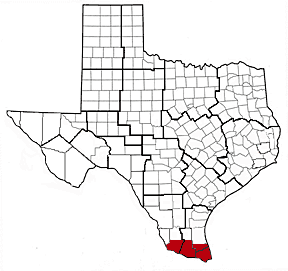
Rio Grande Delta
Principal
Investigators:
Drs. Frank Judd and
Robert Lonard, Department of
Biology, University of
Texas - Pan American
Dr. Melba Crawford, Center
for Space Research,
University of Texas at
Austin
Mapping of Riparian Vegetation
Riparian ecosystems are among the nation's highly threatened natural resources, especially along the Rio Grande River. With recent development of the Lower Rio Grande Valley (LRGV), the amount of natural vegetation is thought to be declining. The purpose of this joint effort is to map the extent of the riparian vegetation and its changes over time. This
was done by using aerial videography (provided by USDA/Weslaco) and satellite imagery.
Remote Sensing of Rio Grande Delta Marshes
This project provided data for the establishment of a wetland basemap for the Rio Grande Delta using airborne and spaceborne remotely sensed imagery. The creation of a wetland basemap on a regional scale will provide the foundation for continuing research in the Rio Grande Delta.
During the course of this
project, airborne sensors
such as CASI and HYMAP were
flown over several sites in
the Lower Rio Grande Valley.

Last Modified: Wed Apr 14, 1999
CSR/TSGC Team Web
|
|
|
|
