Interferometric
SAR for Improved
Topography of Floodplains
CSR
and NASA JPL have recently
undertaken a collaborative
study to develop improved
capability for floodplain
modeling using remotely
sensed data from multiple
sensors.
The main objective of
this research is to provide
the critical input fields
for hydrological models to
enable more accurate
prediction of flooding
events and flood extent in
riverine and coastal
floodplains.
Some of the most
important of these inputs
include an accurate
description of the
topography of the
floodplain, as well as the
state of soil moisture and
vegetation cover, all of
which are often not
well known.
Data are being
acquired and models are
being developed at sites in
Texas and Australia.
On
September 6 and 7, NASA
acquired multispectral
MASTER and interferometric
SAR (TOPSAR) data over the
Finke River and Ellery Creek
near Alice Springs, NT,
Australia as part of the
NASA PacRim 2000 mission
currently being flown
(http://airsar.jpl.nasa.gov/).
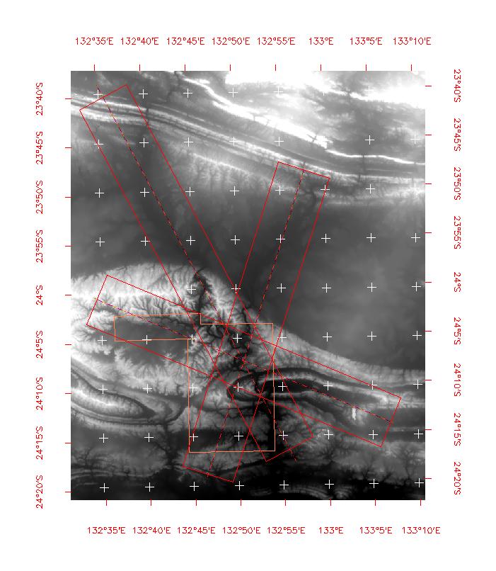
The flight lines over Finke
Gorge Park and Palm Valley
are shown below overlaid on
a regional digital elevation
model (DEM).
A
subset of data from each
flightline, shown below in a
quicklook TOPSAR
interferogram product, is
indicative of the
outstanding quality and the
spectacular topographic
features in the area.

Ellery
Creek |
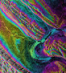
Finke
River Gorge |
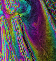
Palm
Creek |
Although
flooding is usually
associated with coastal
environments or river
systems regularly subjected
to the effects of extensive
precipitation, it also
occurs in arid and semi-arid
climates.
In areas of Australia
with low relief, the impact
of runoff on land
degradation is so
significant that hydrologic
modeling studies have been
conducted to evaluate the
effect of topography on
vegetation cover on mountain
ranges, alluvial fans, and
footslopes of drainage
basins.
The Finke River and
Ellery Creek experienced a
100-year flooding event in
February 2000, which will be
studied using these new data
and a previous acquisition
in 1996.
The effect of the
extreme rainfall is shown in
the sequence of Landsat 7
Thematic Mapper images shown
below.
In addition to
contemporaneous flooding,
the Finke is also of great
interest in paleoflood
studies.
These data should
also prove valuable in an
ongoing collaborative study
of these flooding events by
CSR and the U of Arizona http://www.csr.utexas.edu/rs/research/aussie/
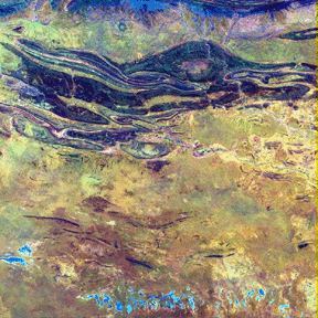
September 23,
1999 |
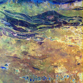
January 29, 2000 |
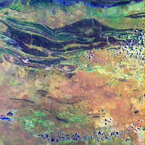
March 1, 2000 |
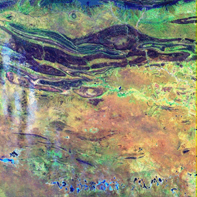
March 17, 2000 |
|

Last Modified: Wed Apr 14, 1999
CSR/TSGC Team Web
|

