
We are a group of UT hydrologists and geodesists; and we are studying water dynamics at MGO. During ten trips spanning the last three years, we have outfitted a mountaintop at McDonald Observatory with a variety of hydrologic sensors. Among them are soil moisture probes, piezometers, boreholes, a meteorological station, and notably a superconducting gravity meter. The gravity meter, or “gravimeter,” which deployed in September 2019, is one of only seventy-five such sensors in the world. It measures how moving environmental masses, such as water and atmosphere, ever so slightly change Earth’s gravity.
We are using these hydro data to:
- Develop non-geodetic estimates of water storage change to help us study how water signals appear in the geodetic instruments at the site, and
- Learn how fractures in volcanic bedrock influence water storage fluxes.
How water storage change affects superconducting gravimeter measurements
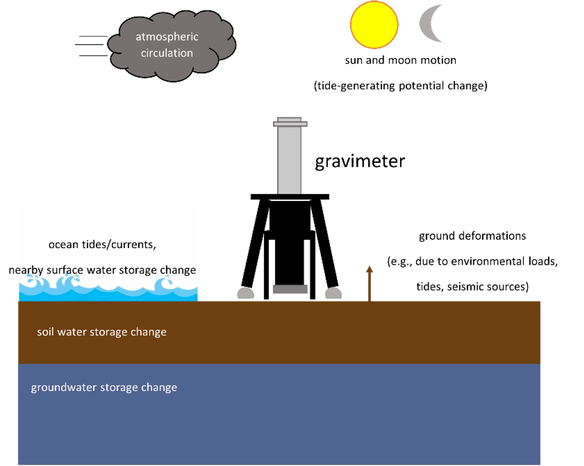
Moving masses (air and water loads) and seismic sources in the environment alter measured gravity. We can predict and model some of these processes, but others (e.g., groundwater change) are difficult to model without direct observations.
A little bit of water doesn’t seem like it could change gravity, but let’s perform a thought experiment. What would happen if a 1m thick disk of water that spanned the whole of Austin, Texas, (111km diameter) were suddenly dropped on the city?
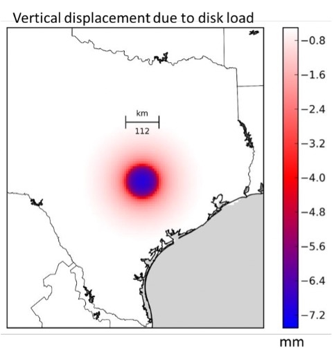
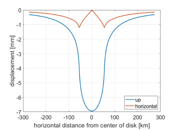
Using the elastic loading theory, we would see up to a 7mm displacement of the earth’s surface! That may not sound like a lot, but when trying to achieve millimeter level accuracy, every drop of water counts. Instead of looking for 1m of water, scientists are looking for water on the scale of 1mm.
Studying fractures in bedrock
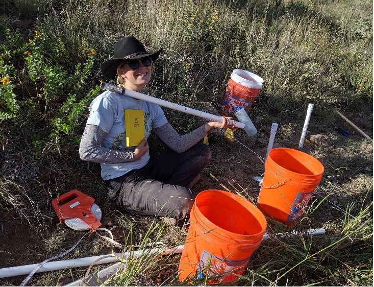
Thanks to UNAVCO (formerly, University NAVSTAR Consortium), we have been able to observe water storage changes in fractured bedrock near the superconducting gravimeter. In September 2017, UNAVCO generously facilitated the drilling of two deep boreholes at MGO, both 30’ deep. At these locations we have been able to measure water saturation with depth with a nuclear magnetic resonance (NMR) probe.
Our additional monitoring infrastructure includes:
- Soil moisture probes
- A full meteorological station
- A piezometer cluster to measure subsurface water pressure and observe lateral flow
- The superconducting gravimeter

With improved understanding of how the water cycle and water storage affects loading and gravity variations, MGO geodetic equipment will become even more accurate in their positioning measurements.
This work is funded by the National Geospatial-Intelligence Agency’s University Research Initiative (project title: “Removing Sub-microGal Hydrologic Signals in Absolute Gravity Observations”) and by UT Austin’s Office of the Vice President for Research.
Contact Information:
Daniella Rempe (rempe@jsg.utexas.edu)
Chris Linick (clinick@utexas.edu)