In the summer of 1969, Apollo XI was the first mission to successfully land people on the Moon. Beyond the American flag they planted there, the astronauts also left something else important behind – a retroflector in the Moon’s Sea of Tranquility region.
Retroflectors can reflect light back to its source, and with minimal scattering. This important device enabled measurement of the distance between the Earth and the Moon in very precise terms. But the retroflector is only one half of the process used to determine that distance. The source of the light that is sent and the device that detects the light reflected back are located on the Earth’s surface.
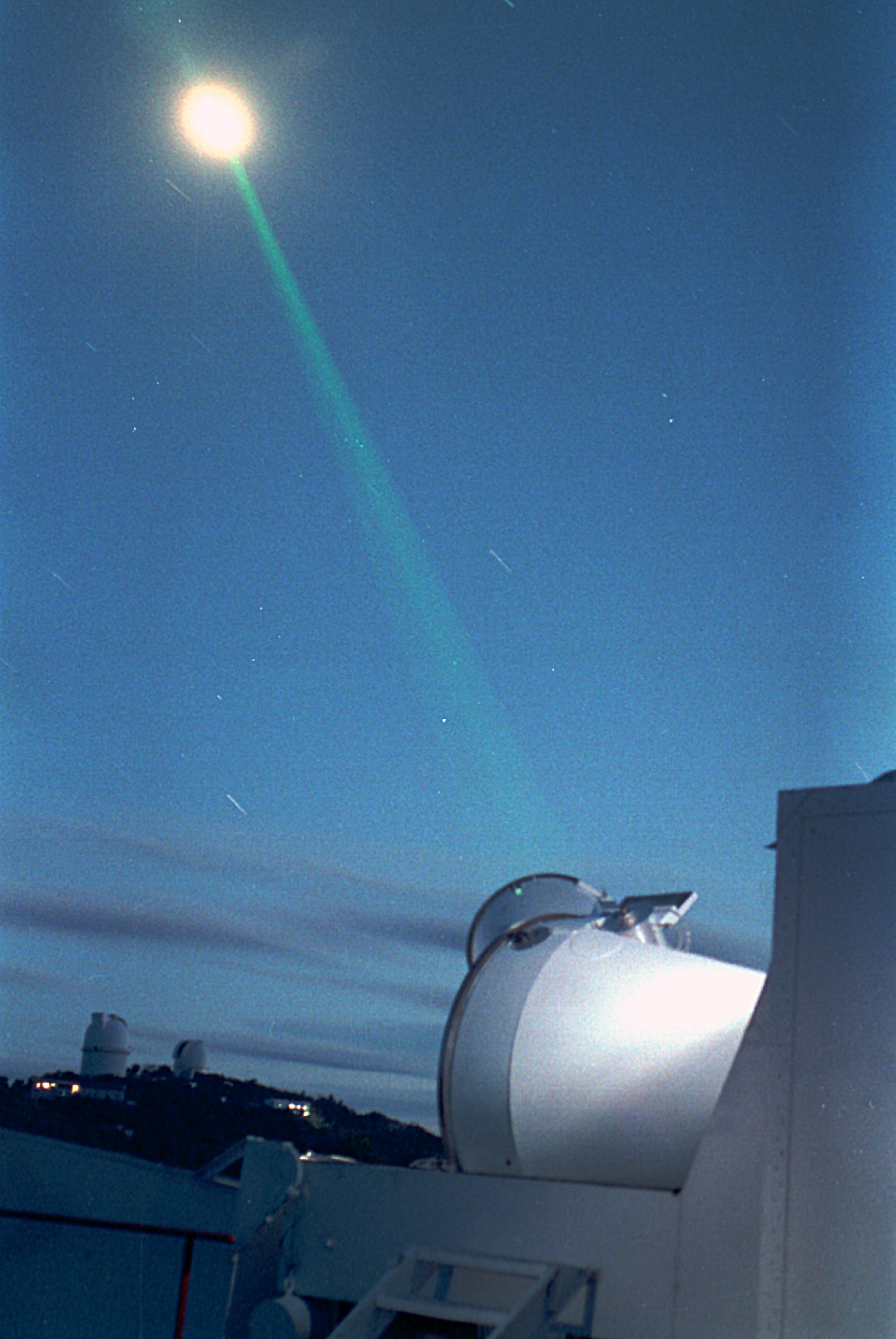
The site was initially intended for a location in Hawaii. However, an inability to meet the Summer 1969 deadline led The University of Texas’s McDonald Observatory to step in. The 2.7m reflecting telescope, funded by NASA, had just become operational at this western Texas location and quickly became the premier Lunar Laser Ranging (LLR) station of the 1970s through the early 1980s, being among only 5 other sites globally with this capability. This LLR was able to measure the distance to the Moon within an accuracy of 10-15cm from a distance of around 384,400 km! During this time, the University of Texas at Austin (UT) also operated NASA’s first Transportable Laser Ranging System (TLRS-1) from the LLR site in the late 1970s and early 1980s.
In 1983, the McDonald Laser Ranging Station (MLRS) replaced McDonald Observatory’s original 2.7-m lunar-only system. MLRS ranged not only to the Moon, but also to artificial satellites in orbit around the Earth. It was designed around a computer-controlled 0.76-m x-y mounted Cassegrain/Coudé reflecting telescope and a short-pulse, frequency-doubled, 532-nm, neodymium-YAG laser with appropriate computer, electronic, meteorological, and timing interfaces. This automation of the system led to reduced operating costs. Initially placed in the saddle between Mt. Locke and Mt. Fowlkes at McDonald Observatory, MLRS was relocated to the top of Mt. Fowlkes in early 1988 to avoid performance-degrading effects at its original location. MLRS’s Satellite Laser Ranging (SLR) data gathered from 1988-2015 and GPS data gathered since 1992 have been very important contributions to the definition of the Terrestrial Reference Frame. MLRS remained functional until September 2019, when it was taken out of commission by a lightning strike.
In the near future, the new Space Geodesy Satellite Laser Ranging System (SGSLR) will continue the MLRS’s decades-long record of data collection on Mt. Fowlkes. The high repetition rate of its new single-photon detection system makes possible millimeter-level accuracy. This next step forward in SLR technology makes MGO a cutting-edge geodetic core site for years to come. As tracking data has been collected for over 50 years at McDonald Observatory, MGO will be one of only a handful of stations in the world with such long records of scientific data. The partnership between UT and NASA has been essential in the creation of this important legacy and continues to pave the way for scientific advancement in the field of geodesy.