
Why Use Remote Sensing to Monitor the Environment?
When we observe the environment that we live in, we may lose sight of the forest for the trees. Remote sensing technology helps us to step back and examine the big picture of our surroundings. Not only can we study a slice in time, but we can also watch and analyze changes in our environment that occur over days, months and years.
 An important goal of the MAGIC program is to transfer the information developed from remote sensing technology to a wider audience of public and private decision makers, government workers, students and private citizens. Our case studies offer a sampling of possible applications of remote sensing and other geospatial technologies. Whether the issue is long-term drought or a sudden wildfire, remote sensing technology can help us to understand where, when, how and possibly even why our environment is constantly changing.
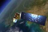
 Satellite-based remote sensing technology allows scientists to collect global data on a daily basis. The same technology can help us to learn more about the biogeophysical processes that cause environmental change. We can monitor urban expansion and prime farmland loss, better prepare for the threat of flooding and other natural disasters, and protect our water and air quality.
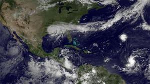
Remote sensing technology has another side that we would like to share with you, too. Watching the Earth’s landscapes, oceans and atmosphere from space is truly fascinating and lots of fun. It’s a great way to revel in the ever-changing beauty of our home planet.