
In response to the outbreak of the COVID-19 pandemic in Texas, CSR’s Mid-American Geospatial Information Center (MAGIC) team is providing crisis decision support to the Texas State Operations Center in Austin and to emergency managers around the state. A public website (moves.csr.utexas.edu/covid19/) allows access to some of the data used for state support through the Modeling, Observation & Visualization for Emergency Support (MOVES) web applications and data services.
The CSR team is working closely with Dr. Lauren Ancel Meyers, UT’s leading pandemic epidemiologist, and her UT COVID-19 Consortium of scientists and with the Texas Advanced Computing Center (TAAC), which is providing high-performance computing and data analytics for modeling the spread of coronavirus.
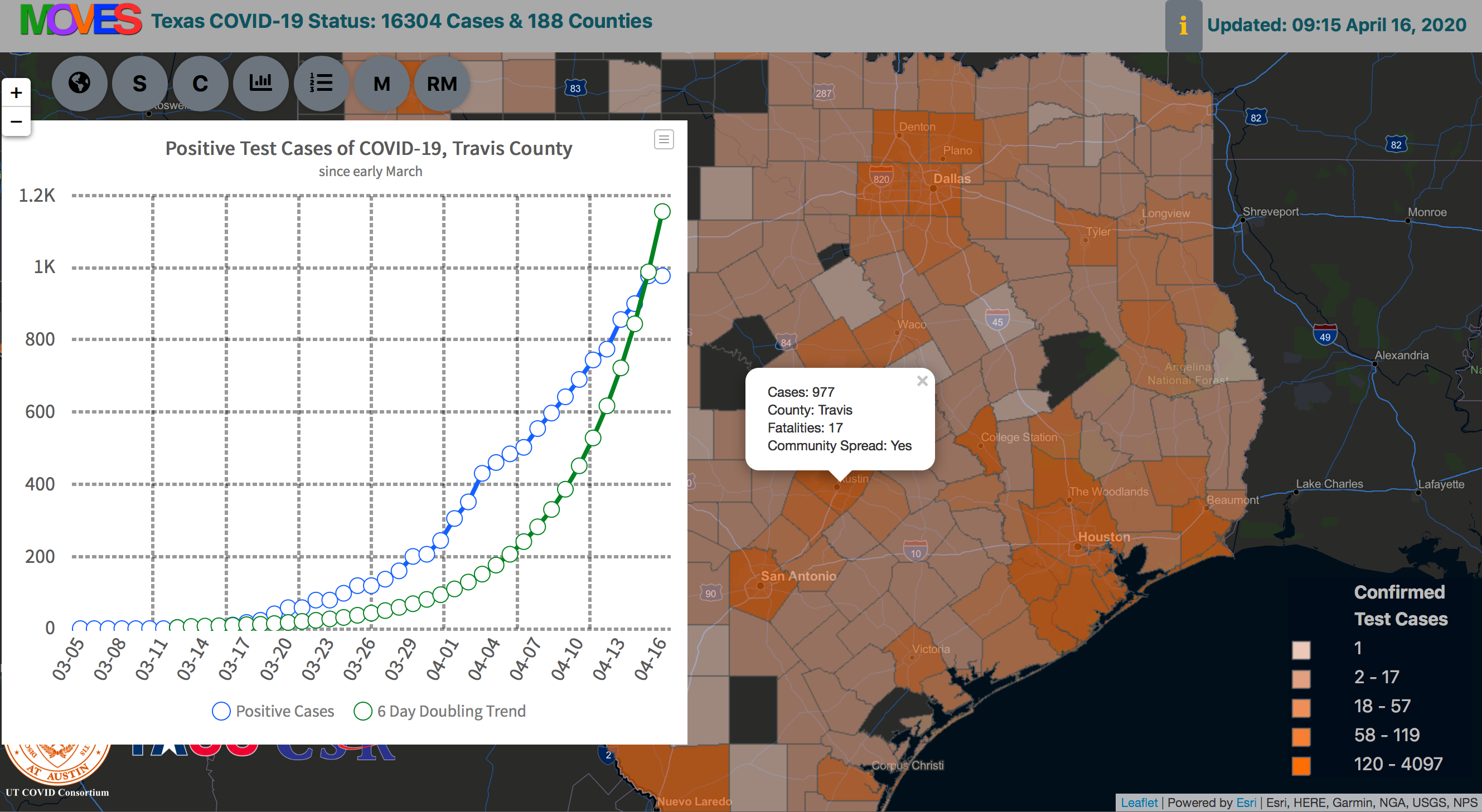
The MOVES Texas COVID-19 Status application allows users to track changing trends in the data collected for positive COVID-19 test cases in every Texas county and to measure the effectiveness of social distancing policies with respect to a reference curve representing a 6-day doubling rate for areas where outbreaks have occurred. The latest results from Dr. Meyer’s 22-city/metro areas pandemic model are also available for users to view and download. The model results illustrate how different degrees of social distancing can reduce the spread of coronavirus infections through the Texas population, allowing future isolation and containment of the virus.
Work in progress by the CSR team focuses on the impacts to vulnerable populations, transmission in rural areas of Texas, early outbreak detection and coordination of state- and county-level response plans.