
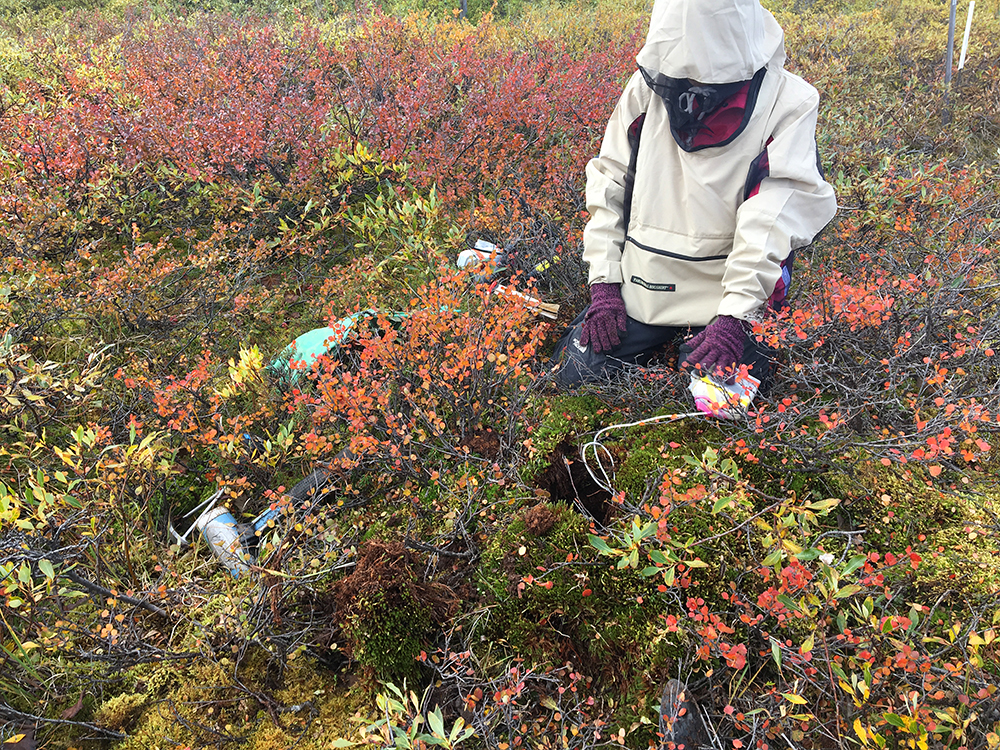
This summer, Sophy Wu, a second-year Ph.D. student studying aerospace engineering, along with Michael O’Connor and Stephen Ferencz, two graduate students from Jackson School of Geosciences, conducted fieldwork at the University of Alaska Fairbanks’ Toolik Field Station, a premier research laboratory established in 1976 for studying the Arctic and its relationship to the global environment.
For two weeks Wu and the team collected soil core samples from both Toolik Lake and the Imnavait Watershed—representative of the older and younger tundra—to measure soil properties, such as porosity, volumetric water content and the active layer thickness.
“Permafrost soils store twice the amount of carbon found in the atmosphere.” said Wu. “When the permafrost thaws, a significant amount of greenhouse gases may be released into the earth’s atmosphere. The field data we collected are essential for understanding the complex feedback between permafrost degradation and a warming climate.”
This three-year project, funded by NASA and led by Ann Chen, an assistant professor in the Department of Aerospace Engineering and Engineering Mechanics, aims to advance NASA’s observation capability from space coupled with on-the-ground validation measurements to understand the hydrologic dynamics in thawing permafrost.
“Remote sensing is critical as Earth’s arctic region covers continent-sized areas that are mostly inaccessible by foot. Once we establish a link between hydrological properties of arctic tundra soils and Interferometric Synthetic Aperture Radar (InSAR) satellite measurements, we will be able to extend our analysis over a much broader region in the North Slope of Alaska,” said Chen.
Wu will return to the Toolik Filed Station for fieldwork over the next two summers. Ann Chen and Bayani Cardenas, a UT professor of geological sciences, will also join the fieldwork team.
Chen’s UT Radar Interferomety group, housed in UT’s Center for Space Research, has received additional funding from NASA to advance InSAR technology, which will be used to detect accurate surface deformation for understanding solid Earth dynamics and associated natural hazard risks.
Source: https://www.ae.utexas.edu/mapping-arctic-tundra