
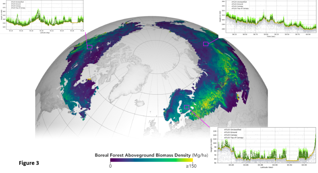
For the last few decades, a series of satellites have used lasers to radically improve our understanding of Earth and how it is changing over time. This technology, satellite laser altimetry, has quantified data on critical climate issues such as melting ice, sea level changes, carbon levels in forests around the globe and the amount of aerosols in the sky.
In new research, an all-woman group of authors from five different institutions, published an anthology of all the important data unearthed by laser altimetry over the last two decades. As these missions remain ongoing, the research illustrates the impact of this technology.
 “We know from 20 years of observation that this is a great technology that can tell stories about our planet through data with unprecedented accuracy and resolution,” said Lori Magruder, an associate professor in the Cockrell School of Engineering’s Department of Aerospace Engineering and Engineering Mechanics, and the lead author on the research published in Nature Reviews Earth & Environment.
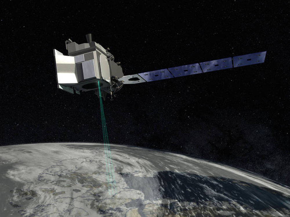
How it Works: A laser altimeter is primarily used to learn about the topography – the height and shape – of an area. A satellite shoots a laser beam from space that illuminates a certain area and then bounces back. The topography of the target area can be determined by how far the laser travels and how long it takes to bounce back.
Background: The original laser altimetry mission – Ice, Cloud and land Elevation Satellite (ICESat) – ran from 2003 to 2009. Its descendant, ICESat-2, launched in 2018 and remains active today. These missions are complemented by the Global Ecosystems Dynamic Investigation (GEDI) mission, which also remains active.
The University of Texas at Austin has a rich history of involvement in laser altimetry missions. Bob Schutz, a former aerospace engineering faculty member, was chosen as the original science team lead on ICESat. Magruder and Amy Neuenschwander, a co-author on the paper and senior research scientist at UT’s Center for Space Research, are both part of the science team for ICESat-2, a group Magruder previously led for a decade.
Why It Matters: After ICESat-2 and GEDI, no further laser altimetry missions are on the books. Showing the effectiveness of this technology is critical to making sure support remains strong for its continued development and deployment.
Every 10 years, the National Academies of Sciences, Engineering and Medicine publish the Decadal Survey for Earth Science and Applications from Space, which will help shape science priorities and guide agency investments into the next decade. The survey, sponsored by NASA, NOAA, and the USGS, is driven by input from the scientific community and policy experts.
The next survey is coming up in 2027, and will certainly play a role in the future of space missions and research.
“We want to make sure the scientific community understands the impact these missions have made,” said Neuenschwander. “These missions will continue to play an important role in understanding the changing nature of our climate and planet as a whole.”
Co-authors on the paper include Sinead Farrell and Laura Duncanson of the University of Maryland, Bea Csatho of the University of Buffalo, Sahra Kacimi of the Jet Propulsion Laboratory and Helen Amanda Fricker of the Scripps Institution of Oceanography at UC San Diego.
Sources:
https://www.ae.utexas.edu/news/how-space-lasers-have-unearthed-new-information-about-our-world
https://cockrell.utexas.edu/news/archive/9793-how-space-lasers-have-unearthed-new-information-about-our-world
Additional Information:
https://bsos.umd.edu/featured-content/researchers-new-paper-gives-overview-20-years-laser-derived-climate-data
https://scripps.ucsd.edu/news/new-paper-pinpoints-key-role-nasa-satellites-monitoring-earths-vital-signs
https://www.buffalo.edu/news/releases/2024/01/space-lasers-have-unearthed-plethora-of-climate-data-over-the-years.html